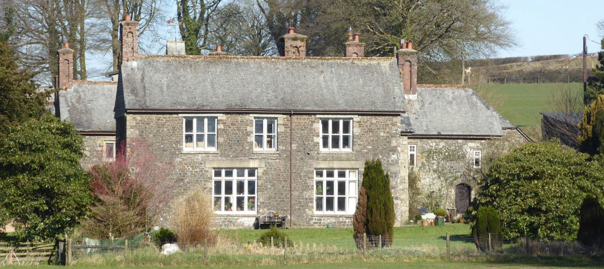


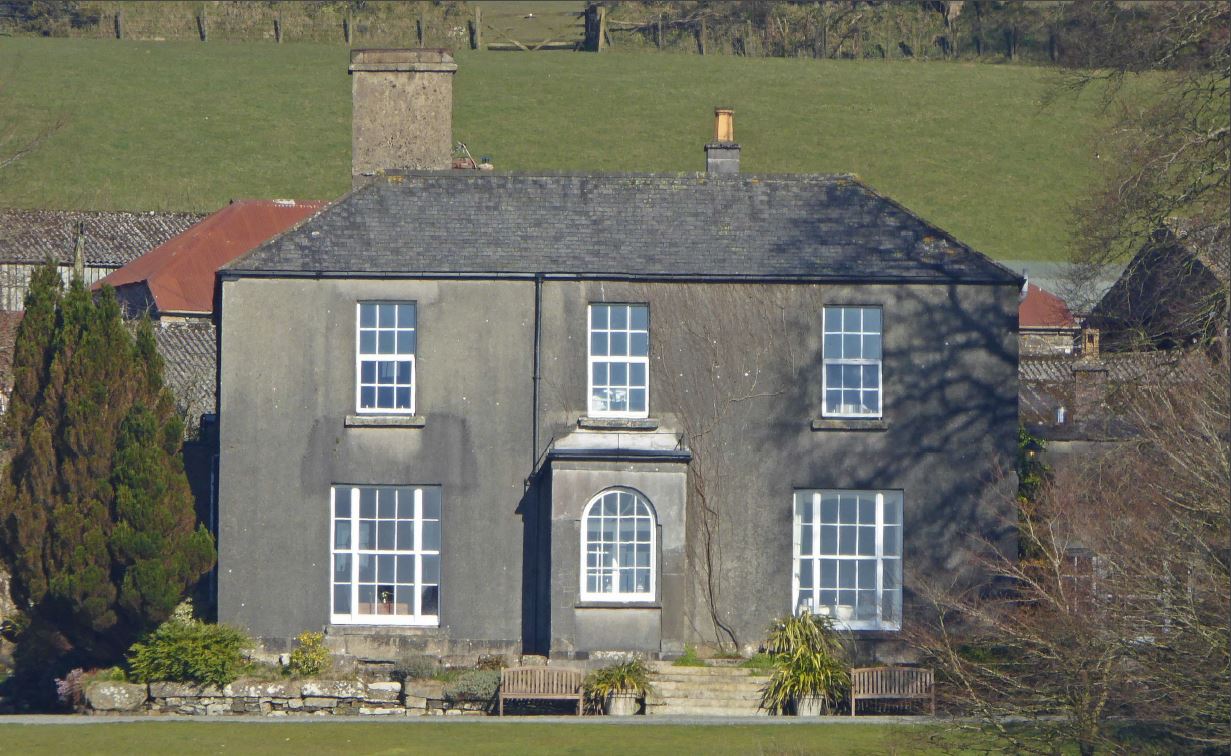
Burnville Farm
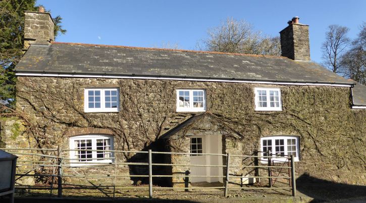
East Langstone farmhouse
Burnville Farm has an interesting history. It stands on land once part of the outlier of the parish of Lamerton. At the time of the Norman Conquest, Lamerton (Lambretona) was held by the Saxon thane Ordulf. In the Doomsday entry for this manor it is shown as being held by Roald L’Adobed (or Rhiwallon) from the King. On this period of history the outlier was mute and was probably not settled land, the nearest settlements being Liddaton (Lideltona), Willsworthy (Wyvelesworth Stondon), Lydford (Lideforda), Warne, Mary Tavy (Wagesfella) and Week (Wyk Dabernon).
In 1100, Roald L’Adobed entered religion and his group of estates, including Lamerton, vested in the crown and were granted to William Gifford. The Giffords held the manor for over 150 years. The outlying part of this manor however, was not granted to William Gifford but to Plympton Priory. The date of this gift is not known but it was before 1156 and it was not mentioned in the disposal of Roald’s lands so was possibly given to the Prior by Roald himself, the Doomsday holder of Lamerton.
Later, in a confirmatory charter signed by Henry II and dated to about 1155 confirming the estates held by the Prior of Plympton, we find the following:
(225) The whole land of Watrifalla (Waterfall in Brentor parish) and
(226) Langstan (Langstone Manor in Brentor parish) and
(227) Wuddemanneswella with the Furze Brake (Woodsmanswell in Brentor parish) and
(228) Rughadona (Rowden in Brentor parish)
These lands are the ⅓ part of Lamerton (the whole outlier) and recorded at the Dissolution as being worth £9-11-2d and being part of the Manor of the Waterfall. Also listed is a shilling’s worth of land at Brent (part of Brentor parish). Although granted to one Arthur Champernowne at the Dissolution, they were later divided and did not remain in one person’s hands as was the fate of Tavistock Abbey possessions.
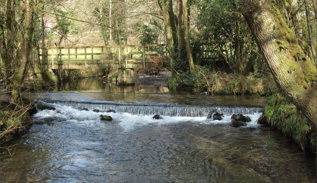
The outlier boundaries are typically Saxon and cover an area stretching from the River Lyd, starting at the ford near Lipscliffe, following the river upstream past the waterfall and Lydford Bridge at the other end of
Ford near Lipscliffe
the gorge, under the viaduct, then turning south-east up the feeder stream and across the A386 to Willsworthy Camp, then westwards to another feeder stream following it down past Hall Farm and the clapper bridge to near the Manor Hotel [Mucky Duck Inn].
Here the boundary turns back on itself to the River Burn following it downstream to meet with the Liddaton lands at Brinsabach. From there the outlier boundary follows the feeder stream to Holyeat, turning north-east to skirt the tor, then north-west past the Brentor Inn to skirt Rowden and join a nearby feeder stream at its head and then following the stream down past Burcombe to rejoin the River Lyd at the ford. These feeder streams, chosen all those centuries ago as boundary markers, are still flowing today.
In Benjamin Donn’s Survey of Devon – 1765, Burnville is shown as East Longstone, and Langstone Manor as West Longstone, where the Herring family is listed as being in residence. Also in this survey, Burn Lane, surrounded by Burnville land, is shown as a settlement or hamlet. The late Freddie Wrench of Burn Lane once told the writer he was convinced of the truth of this and that the verges and strips of land fringing the lane held many ‘hovels’, the homes of the labouring class. Such primitive shelters, made of cob, wattle and daub and thatched with branches and turves, would leave no trace, apart from some possible sherds or artefacts.
For many years the Herring family held Langstone and its lands. In 1873, Phillip Herring is listed in Return of the Owners Land as holding 474 acres of land in Devon, approximately the combined acreage of both Burnville and Langstone. The land on which Burn Lane House now stands was first leased (three lives lease) and then purchased from the Herring family. So the tie with Burnville land is significant. The Brentor Inn used to be called the Herring Arms.
Modern Burnville
The Ward family (Ward and Chowen, D Ward and Son) purchased Burnville in 1907 and in 1944 sold the whole estate to the Church Commissioners for £15,500, as did the owners of Langstone Manor, the latter remaining as sitting tenants. In recent years the Commissioners have been selling land, including Burnville, Langstone, Week, Burns Hall etc in order to release money for other investments. It is interesting to note that the Russell family, the Bedfords, along with others, still own the sole rights for the extraction of minerals on Burnville land.
John Bodman, the previous owner of Burnville, who bought the estate from the Church Commissioners, told the writer in the 1960s, at the time the University of Belfast was conducting a ‘dig’ at Lydford for remains of the Saxon settlement, that they would find more Saxon history on his land than they ever would at Lydford!
Up to the last war, Burnville employed many men and horses. The house is a listed late Georgian or Regency building and replaced the earlier farmhouse, which still exists close by, now sadly neglected and showing its years.
In the 1880s, many parishes were realigned and the Lamerton outlier fused with Brentor to form the parish we know today. We are very shortly [1987] to change our boundaries once again taking in the area known as West Blackdown from Mary Tavy and loosing all that land to the north and east of the clapper bridge to Lydford.
It would seem that the history pages of Brentor are once again being turned with the sale of both Tavistock Abbey and Plympton Priory lands. It is always sad when land changes hands. We can never really claim outright ownership, only perhaps act as trustees for our allotted span. The land goes on and with it the love, toil, memories, hopes and aspirations of the previous owners, tenants and farm workers over the centuries.